|
Melchior Klayber (?) |
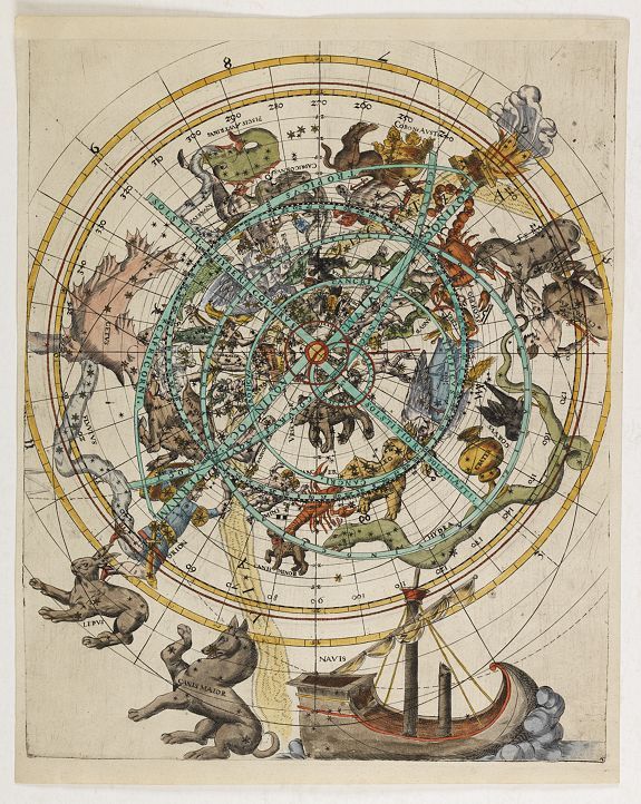
Planisfero celeste settentrionale con sovrapposta volvella reticolare, Vienna 1569 (?)
|
Melchior Klayber (?)
Planisfero celeste settentrionale con sovrapposta volvella reticolare, Vienna 1569 (?)
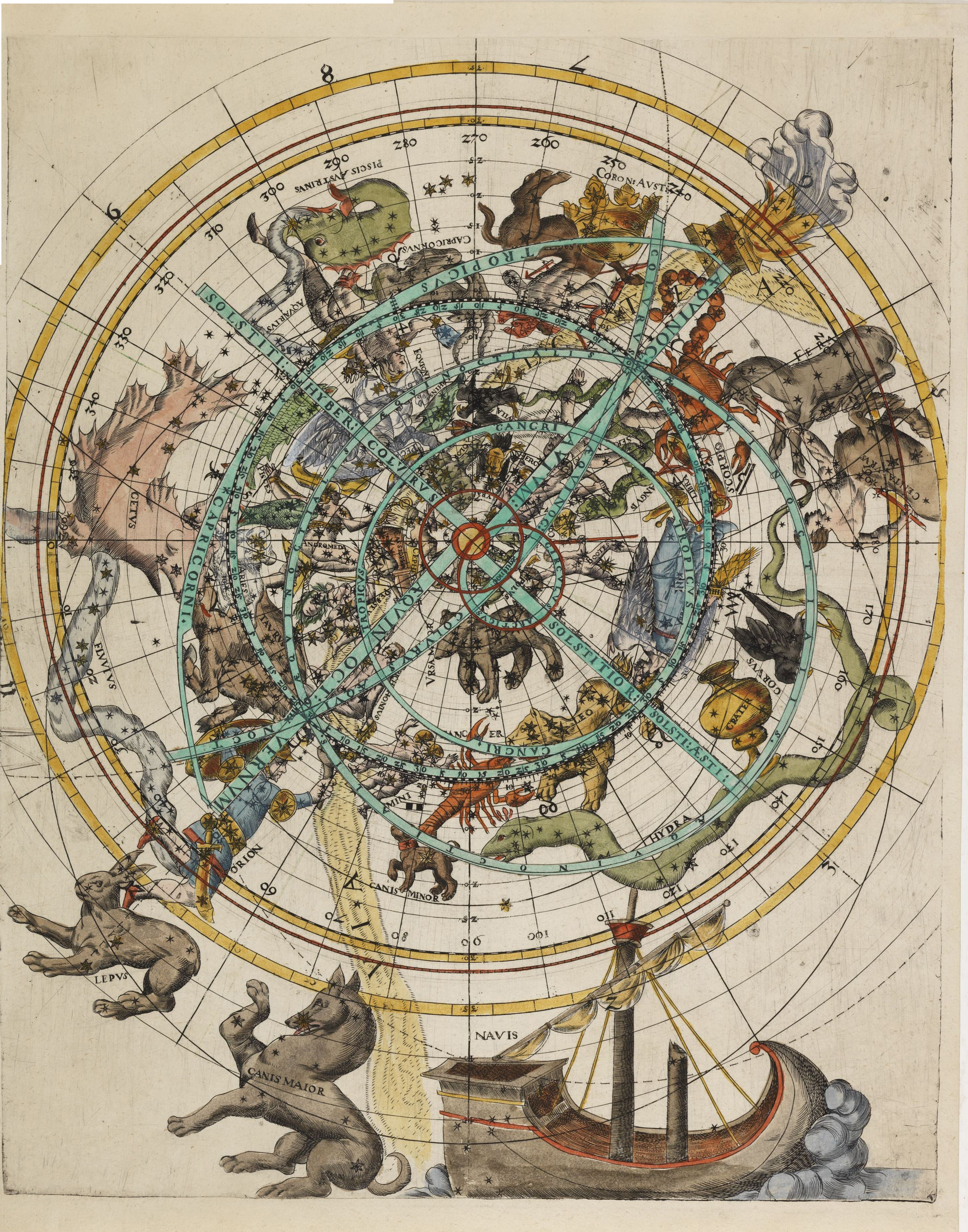
La grande, cm 43 per 34,9, e rarissima tavola esaminata in questa pagina è attualmente proposta in vendita da Paulus Swaen che la presenta come opera prodotta a Vienna nel 1569 da Melchior Klayber.
Ho aggiunto nelle indicazioni presenti nei titoli il punto di domanda perché in effetti non esiste uno studio del documento che possa attestare e confermare con sicurezza quanto asserito.

https://www.swaen.com/antique-map-of.php?id=25017
Per analizzare una tavola di autore e data sconosciuta puoi leggere il seguente articolo:
RICONOSCERE GLI AUTORI E DATARE LE MAPPE CELESTI
http://www.atlascoelestis.com/introduzione2.htm
http://www.atlascoelestis.com/introduz%20carta%20autore.htm
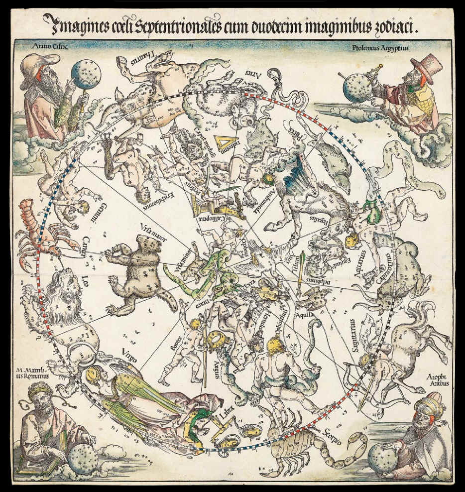
Le caratteristiche stilistiche dei personaggi mitologici rappresentati, il loro numero ed il loro elenco pone comunque la nostra tavola come una erede di quella prodotta da Dürer all’inizio del cinquecento. Mentre la mancanza di nuove costellazioni oltre a quelle tolemaiche e la mancanza di alcuni particolari come le lettere greche del metodo Bayer per identificare le stelle la pongono in un’epoca precedette al 1603, anno di pubblicazione dell’Uranometria del Bayer.
Albrecht Durer
Imagines coeli Septentrionales cum duodecim imaginibus zodiaci, Norimberga 1515
http://www.atlascoelestis.com/durer.htm
Iohann Bayer
Uranometria , Augusta 1603
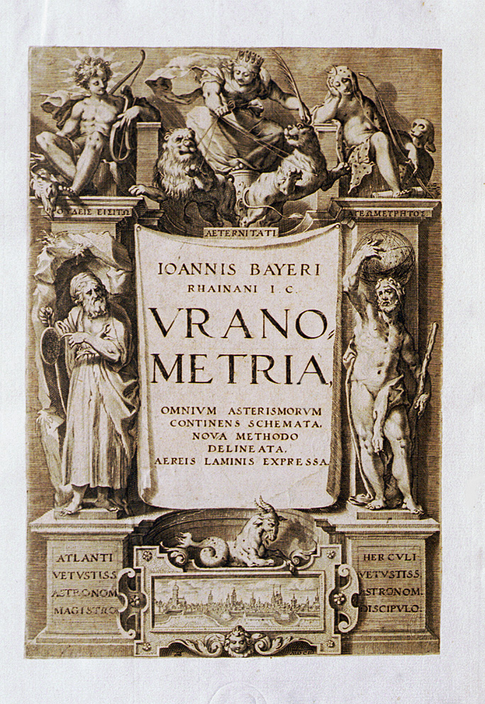
http://www.atlascoelestis.com/4.htm
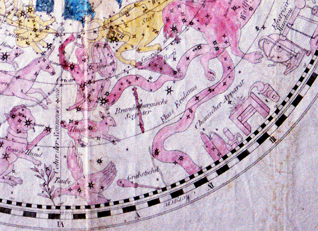
Anzi la data deve essere ulteriormente anticipata a prima del 1572, anno dell’esplosione della Supernova in Cassiopea, osservata tra gli altri da Tycho Brahe, perché esaminando nella nostra tavola questa costellazione non troviamo traccia, come succede invece in quasi tutte le tavole prodotte negli ultimi decenni del cinquecento, della stupefacente nova.
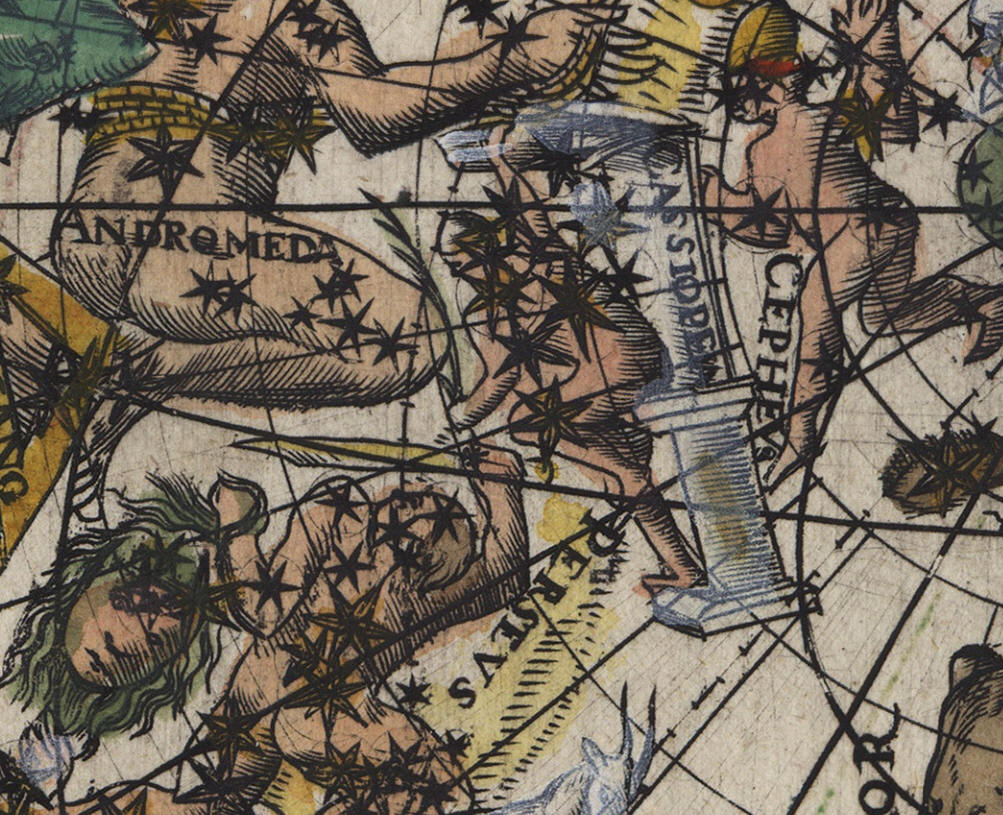
Cassiopea, manca la Nova del 1572
Tycho Brahe
De nova et nullius ævi memoria prius visa Stella, iam pridem Anno à nato CHRISTO 1572, mense Novembrj primùm Constecta, contemplatio matematica, Hafniae 1573

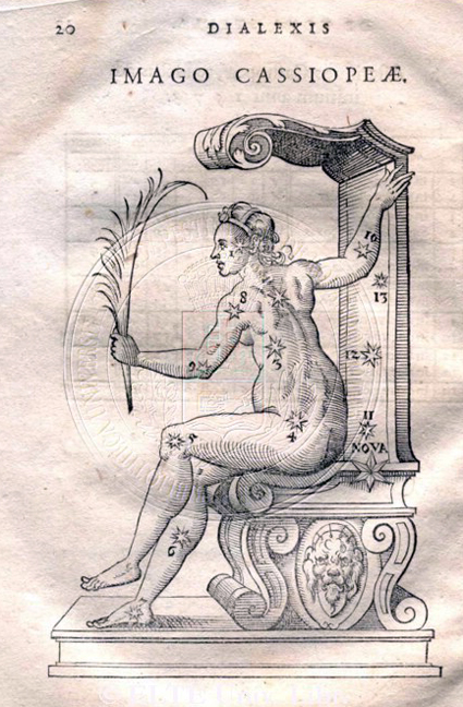
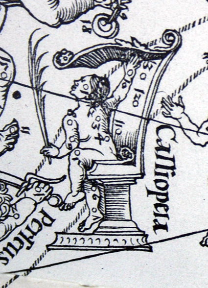
Cassiopea in Ticho Brahe, Thaddaeus Hagecius Ab Hagek con la Nova e Durer senza Nova: la prima tavola in proiezione concava, le altre due, come anche quella di Klayber, in proiezione convessa
http://www.atlascoelestis.com/Tycho%201610%20base.htm
http://www.atlascoelestis.com/Hagecius%20Pagina.htm
Alla tavola è sovrapposto e incollato un reticolo a volvella tipico degli strumenti astrolabici e calendariali che può aver spinto qualche analista a pensare a Melchior Klayber come probabile autore.
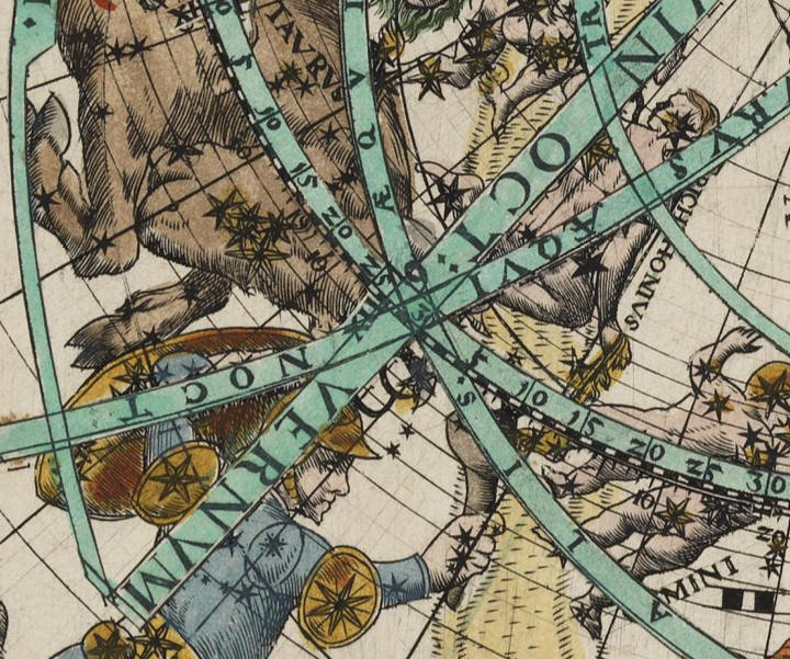
particolare del reticolo a volvella
M. Klayber tra le sue attività annovera infatti anche quella di calendarista e nel 1569 aveva edito diversi testi alcuni dei quali su questo argomento, vedi l’elenco alla pagina

http://www.worldcat.org/identities/viaf-62467576/
In particolare, secondo E. Zinner, Entstehung und Ausbreitung der Coppernicanischen Lehre , 1943, p. 277 nel testo Praecepta de nova supputandorum motuum coelestium ratione: In magnum opus astronomicum ... del 1569 l’autore utilizza la teoria copernicana della precessione formulata da Copernico nel suo De Revolutionibus del 1541 e la nostra carta all’esame di Elly Dekker, https://www.vintage-maps.com/en/antique-maps/celestial-charts/anonymous-northern-sky-before-1569::11694 , è compatibile con la teoria copernicana della precessione.
Fondamentale però per la datazione della tavola è la presenza nella carta su cui è stampata di una filigrana uguale a quella che l’esperto Piccard denota nel suo database con il codice # 24004 e utilizzata dai tipografi a Vienna intorno al 1569, (Gerhard Piccard, Die Wasserzeichenkartei Piccard im Hauptstaatsarchiv Stuttgart, Stuttgart, W. Kohlhammer, 1961-1997 )

(https://it.wikipedia.org/wiki/Filigrana_(codicologia)
Per cortesia di
GÖTZFRIED ANTIQUE MAPS

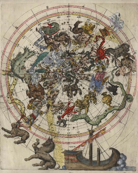
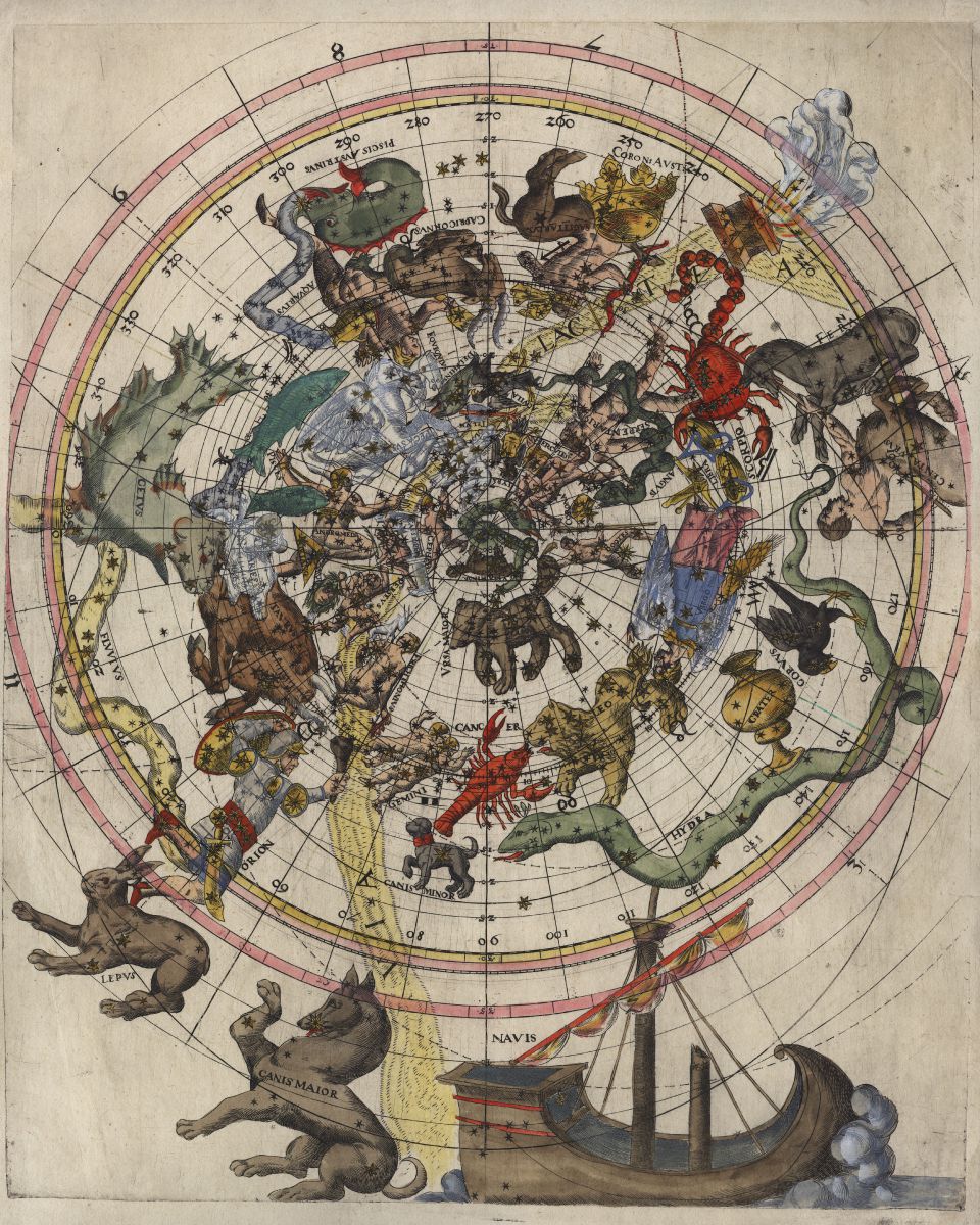
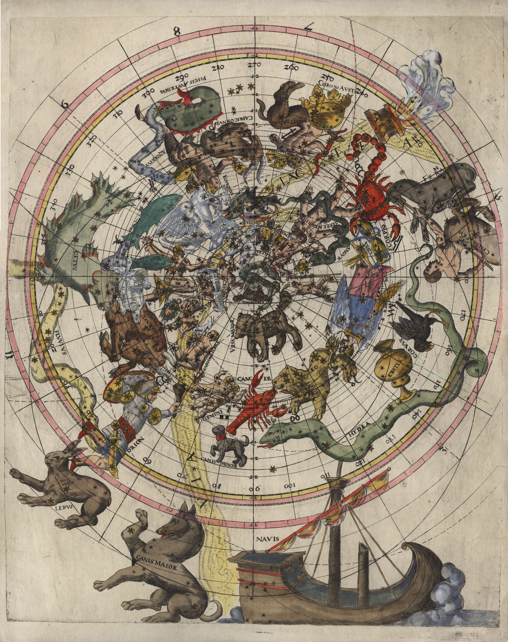
Propongo la seguente scheda descrittiva curata con l’apporto di Elly Dekker di un’altra copia del nostro planisfero privo però della volvella sovrastante:
DESCRIPTION
Unrecorded Star Map of the 16th Century.
A large, scarce 16th century celestial chart of the northern sky. We could not locate any bibliographical information about this engraving. It is printed on a paper with a watermark identified as #24004 from Piccard watermark database. The same paper was used for a document from Vienna dated 1569. Consequentially the paper was manufactured in or before 1569.
The following information related to this chart is kindly provided by Elly Dekker:
-1. The map is a stereographic projection with the north ecliptic pole in the centre (not to be confused by the more common astrolabe which is a stereographic projection with the north equatorial pole in the centre). It extends from ecliptic latitude +90° to about -50° (the star delta CMa with a Ptolemaic latitude -48° 45' is marked).
-2. The map is made for the epoch Pt-6° 40'. The stars gamma Ari and alpha Vir, which according to the Ptolemaic stars catalogue have longitude of respectively 6° 40' and 176° 40', are on the map at respectively zero longitude and 170°. This suggests that the maker worked with Ptolemy. For this epoch Pt-6° 40' the colures, equator, north polar circle and the tropics are drawn by fullcircles.
-3. There is another epoch indicated in the map which is about 48° and 'a little more' from the main epoch. If we estimate 'the little more' as 20', we arrive for this second epoch at Pt-55°. For this epoch the colures, equator, north polar circle and the tropics are drawn by dotted circles.
-4. There are two scales at the border of the map. The outermost scale numbers signs [1-12, but only a few numbers are marked] but neither scale seem to belong to the elliptic for one of the two epochs marked on the map. There are numbers which mark the longitude fore the epoch Pt-6° 40' inside the innermost scale but these numbers do not agree with the division of the scale.
-5. The iconography of the constellation north of the ecliptic is a close copy of the northern map by Dürer of 1515 which is also a stereographic projection from the north ecliptic pole. This northern 'copy' was extended to southern constellations with variations in iconography.
-6. The map shows only the classical Ptolemaic constellations because it served a historic purpose. One cannot from this deduce a date. The map is an early example of the type of modern maps one finds in publications of the works of Manilius and Hyginus. There are however to my knowledge no examples known of in the projection of the present map.
-7. The date of the map can only be deduced from the historical problem it intents to illustrate. The epoch Pt-6° 40' and Pt-55° are equivalent to about 340 BC and 3800 BC, respectively. The first date is close to Eudoxus but his equinoxes are not at Pt-6° 40'. It seems that the modern maker had some reason to make the beginning of constellation Aries coincident with the equinox. The latter date recalls the Anno Mundi. Jewish and Christian sources cite for this value 3761 BC and 3952 BC. This could point to an illustration in books on Chronology. However, astrologers also showed an interest in the Anno Mundi.
-8. The two epochs connected with the map (Ptolemy - 6° 40' and Ptolemy - 55°) are closely connected with the precession theory introduced by Copernicus in his De Revolutionibus in 1541. This theory was short-lived and rejected at the end of the sixteenth century.
-9. According to E. Zinner, Entstehung und Ausbreitung der Coppernicanischen Lehre, 1943, p. 277, there was an astronomer in Vienna, Melchior Klayber, who used data from the Copernican precession theory in 1569 in a publication Praecepta de nova supputandorum motuum coelestium ratione, Vienna 1569.
Concluding the map was printed most likely in Vienna during the second half of the 16th century and is related to the astronomer Melchior Klayber.
DETAILS
|
Cartographer |
Anonymous |
|
Title |
[Celestial Chart - Himmelskarte] |
|
Publisher, Year |
Vienna, before 1569 |
|
Plate Size |
43.3 x 35.5 cm (17.0 x 14.0 inches) |
|
Sheet Size |
46.3 x 36.8 cm (18.2 x 14.5 inches) |
La tavola provvista di volvella
La tavola senza volvella
Particolari

Polo eclittico
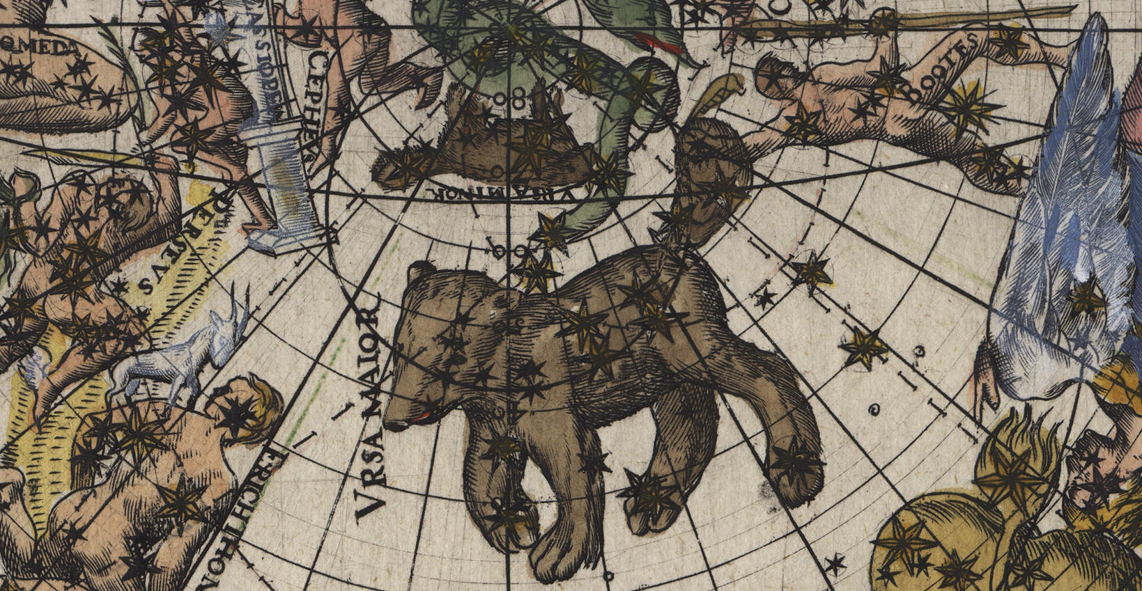
Ursa Maior
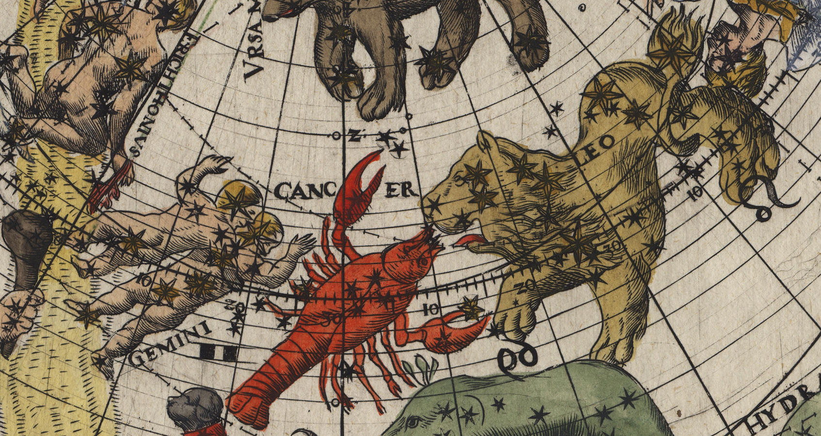
Gemini, Cancer, Leo
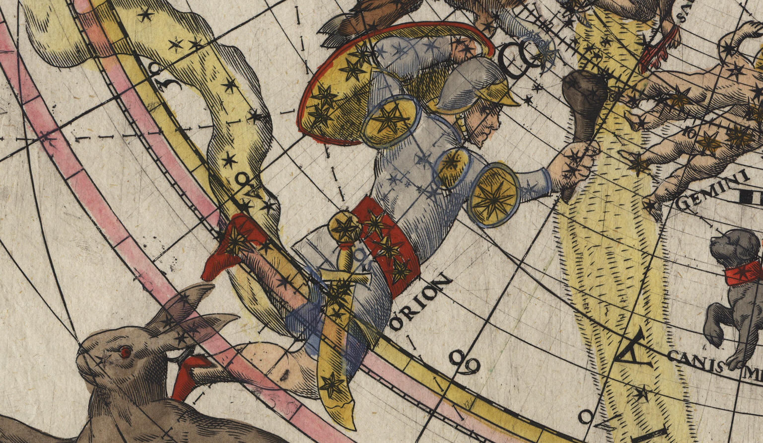
Orion
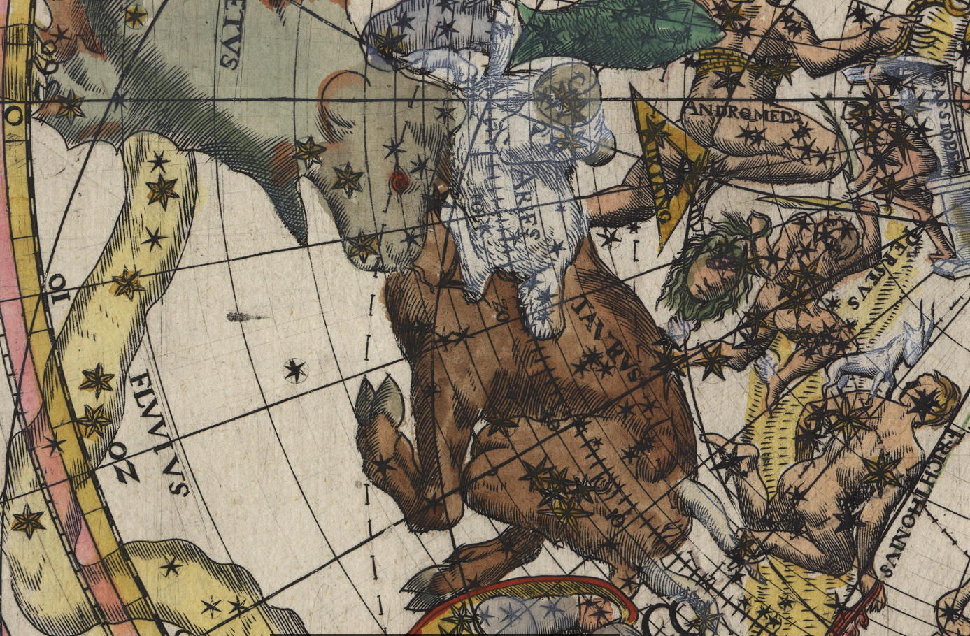
Aries, Taurus
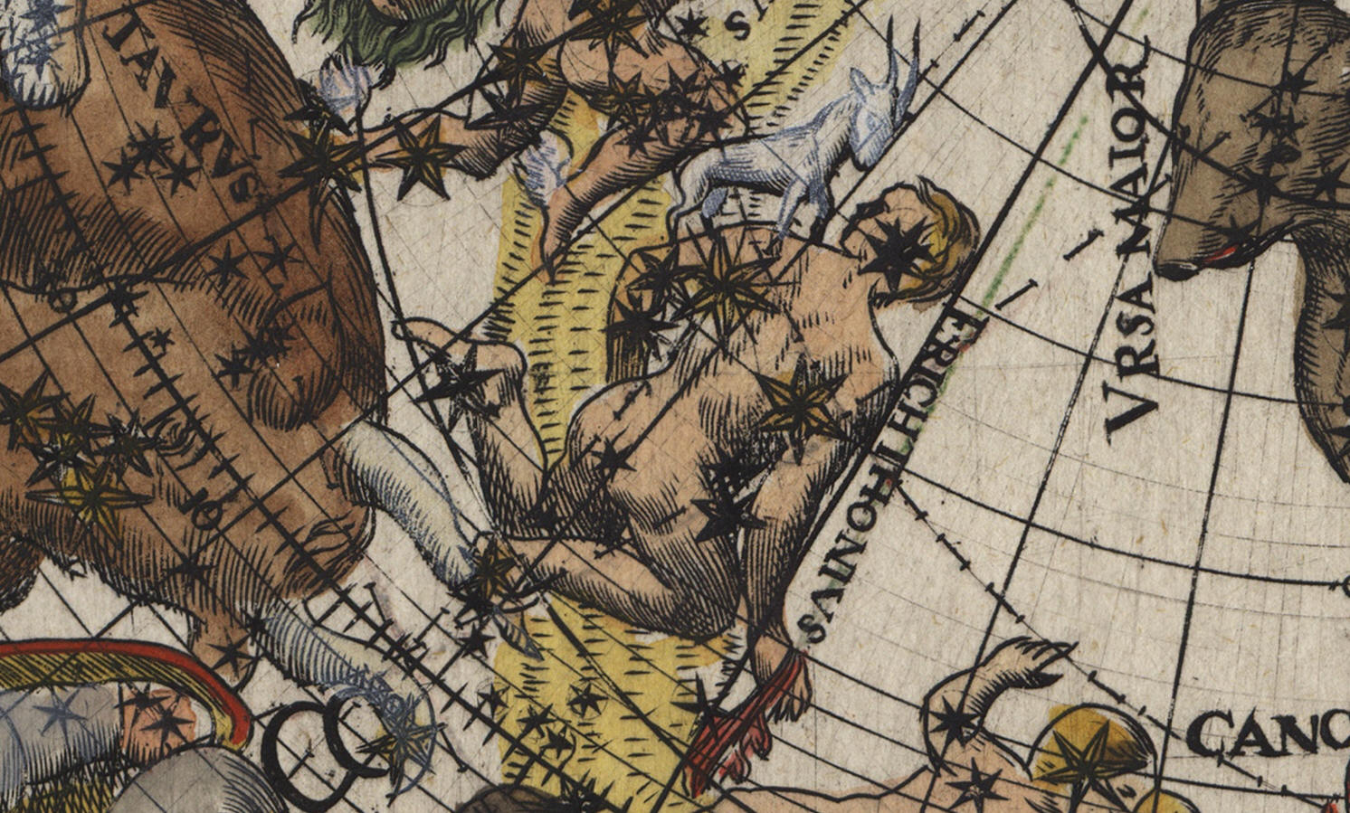
Erichthonius (Auriga)
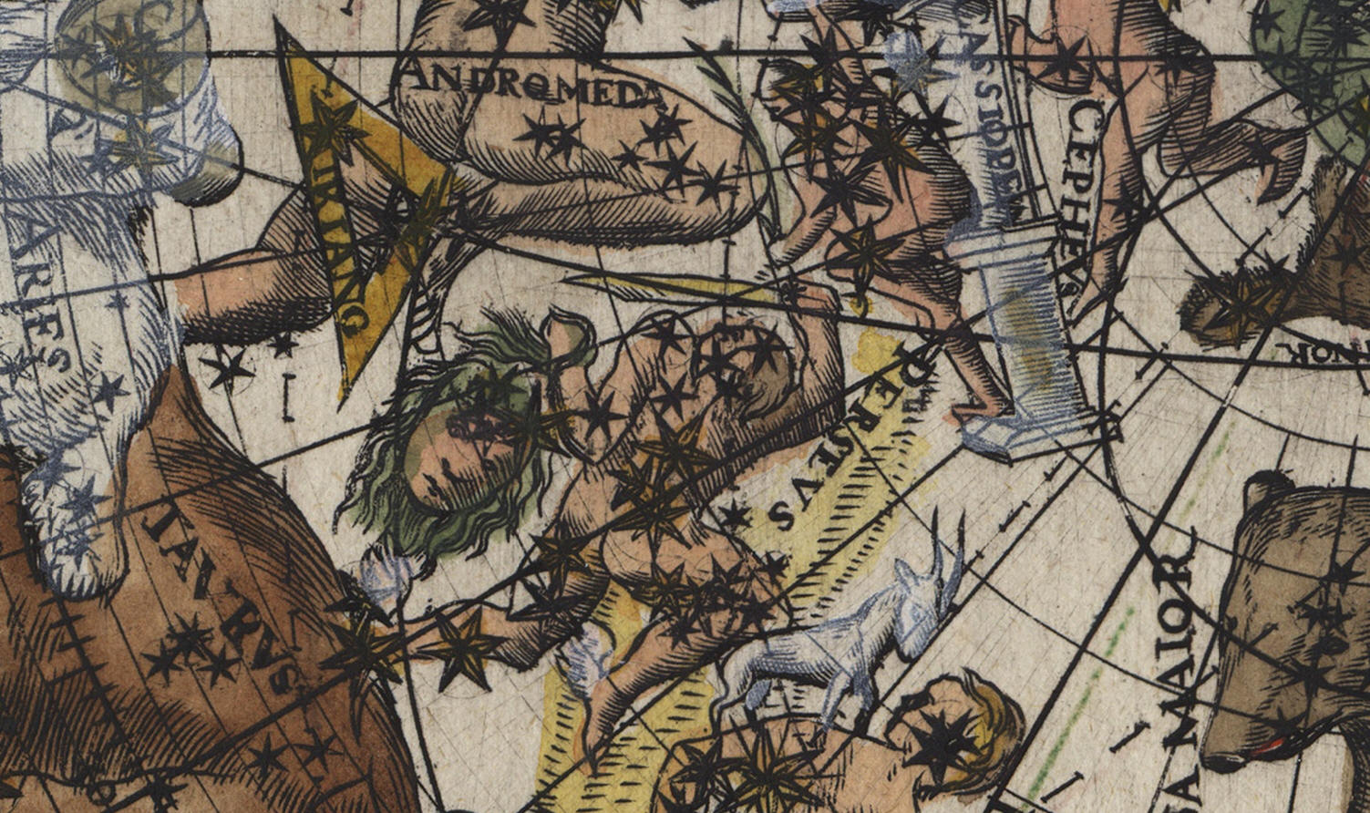
Perseus
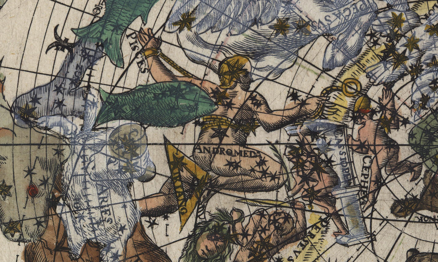
Andromeda, Triang., Cassiopea, Cepheus

Pisces, Pegasus, Equiculus, Delphinus, Olor (Cygnus)

Aquarius, Capricornus, Piscis Austrinus
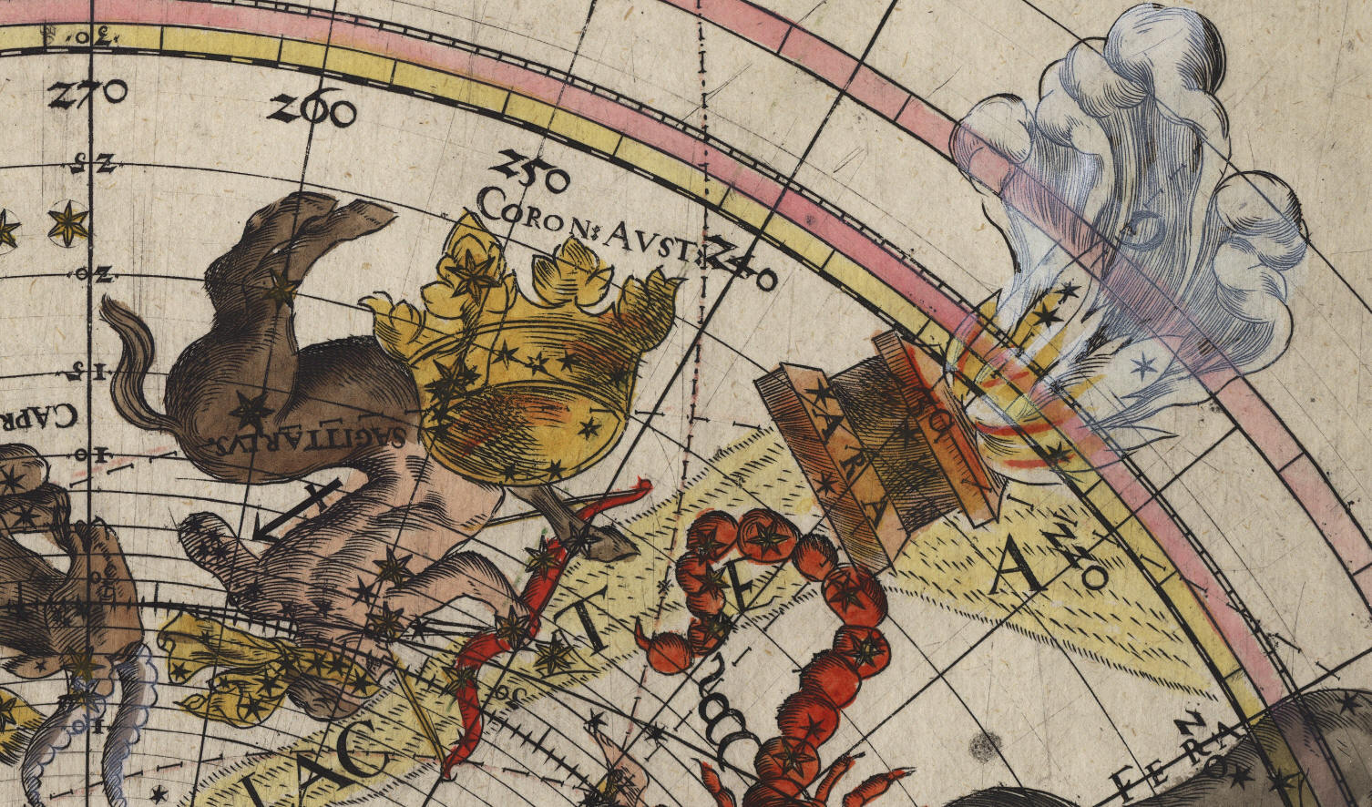
Sagittarius, Coron. Aust., Ara
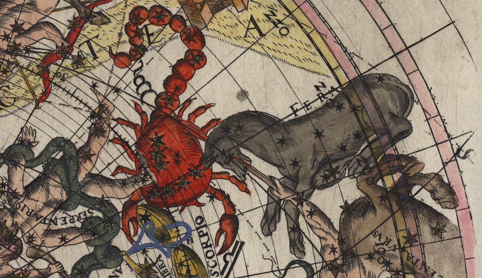
Scorpio, Fera
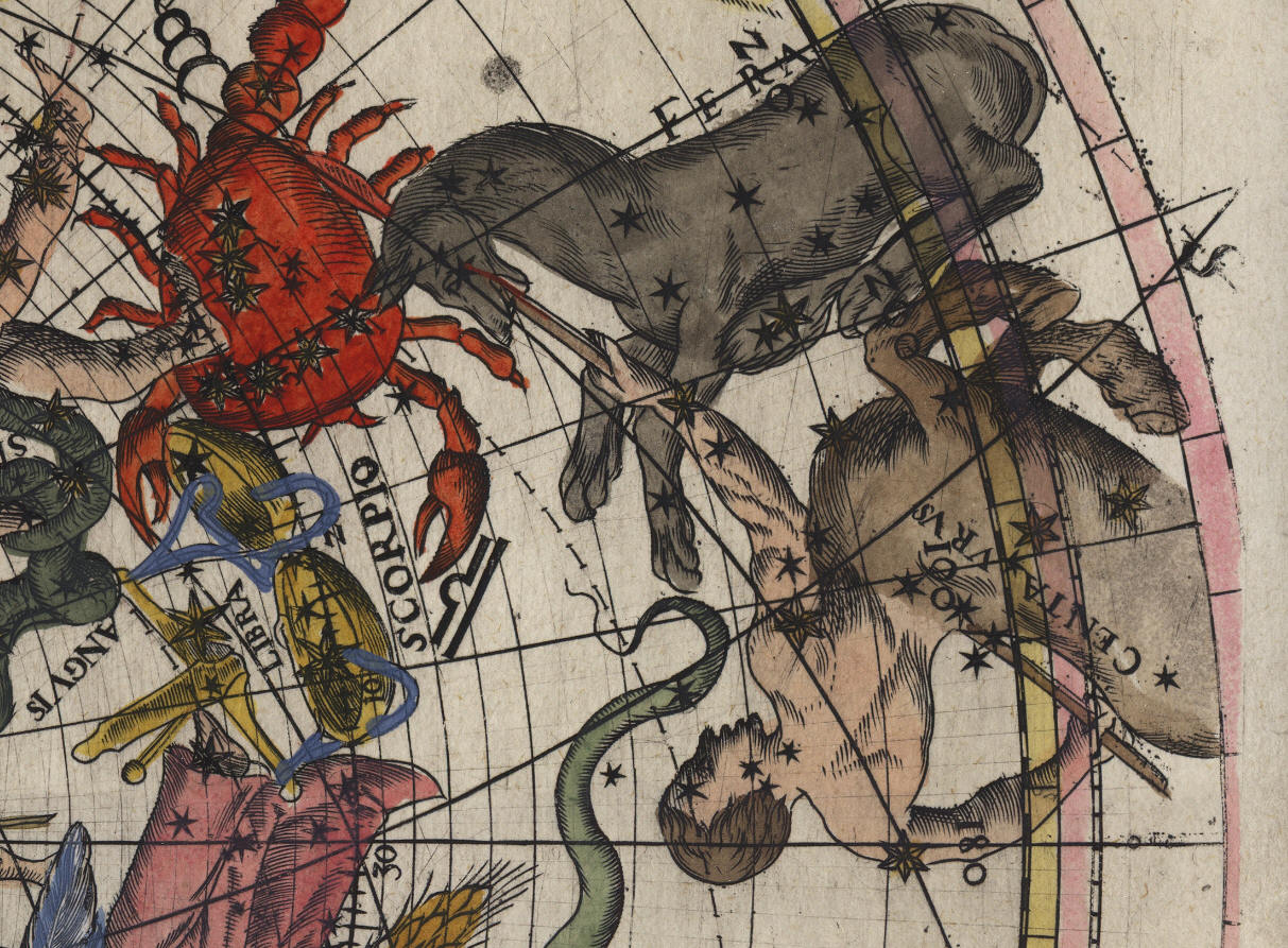
Centaurus, Fera, Libra
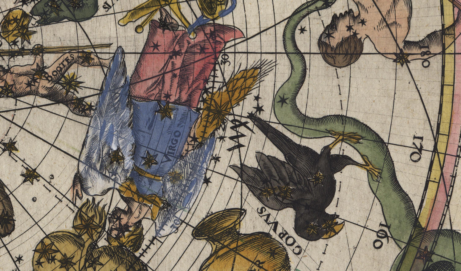
Virgo, Corvus
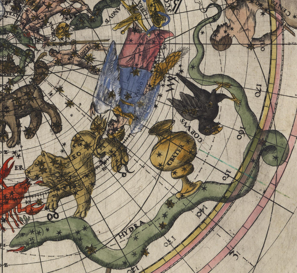
Hydra, Crater, Corvus
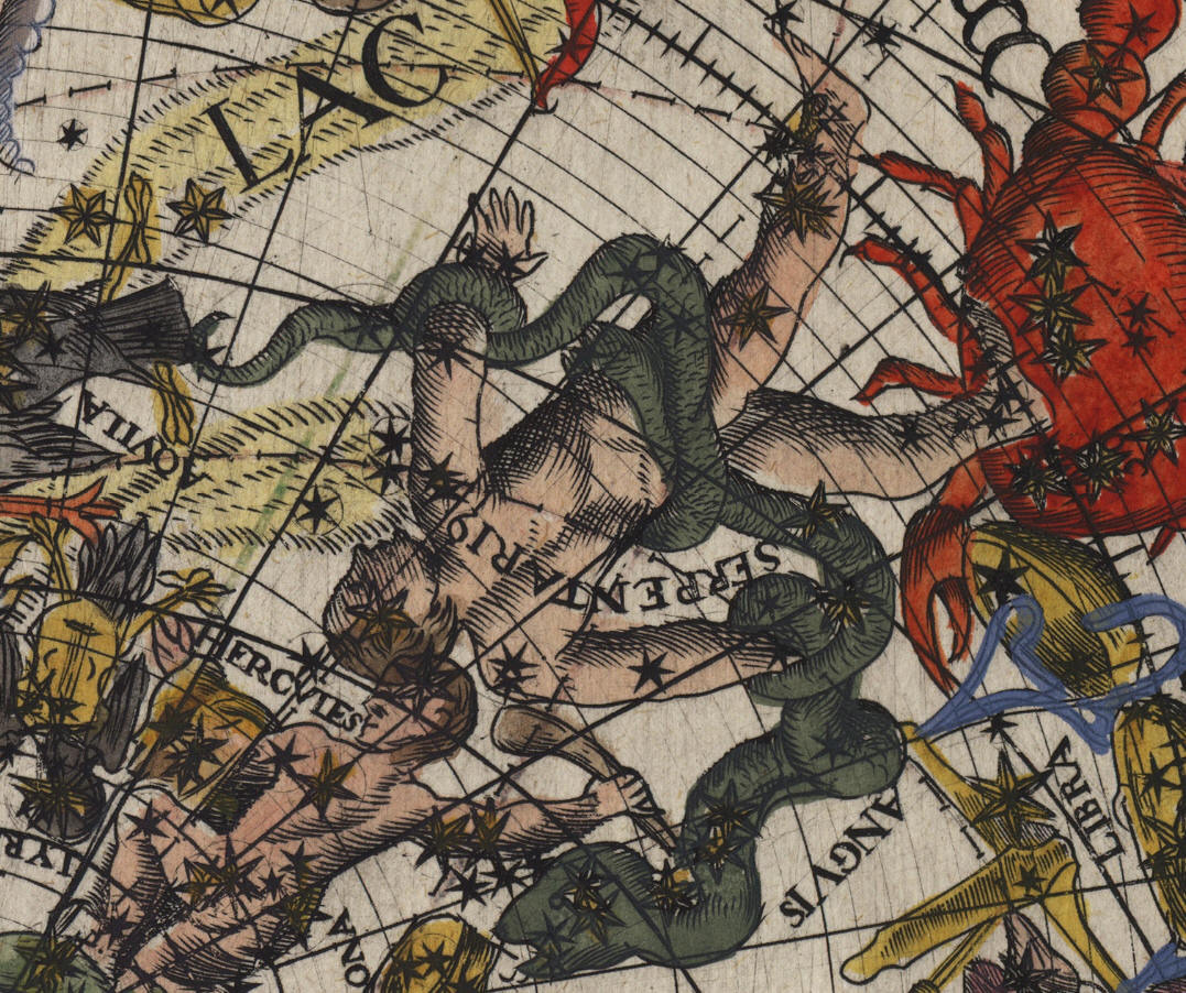
Serpentario, Anguis (Serpens)
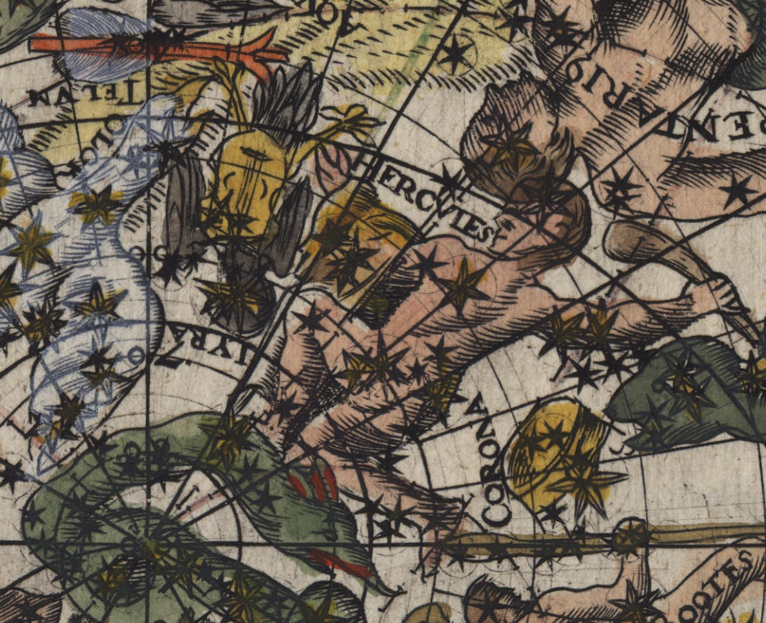
Telum, Hercules, Lyra, Corona
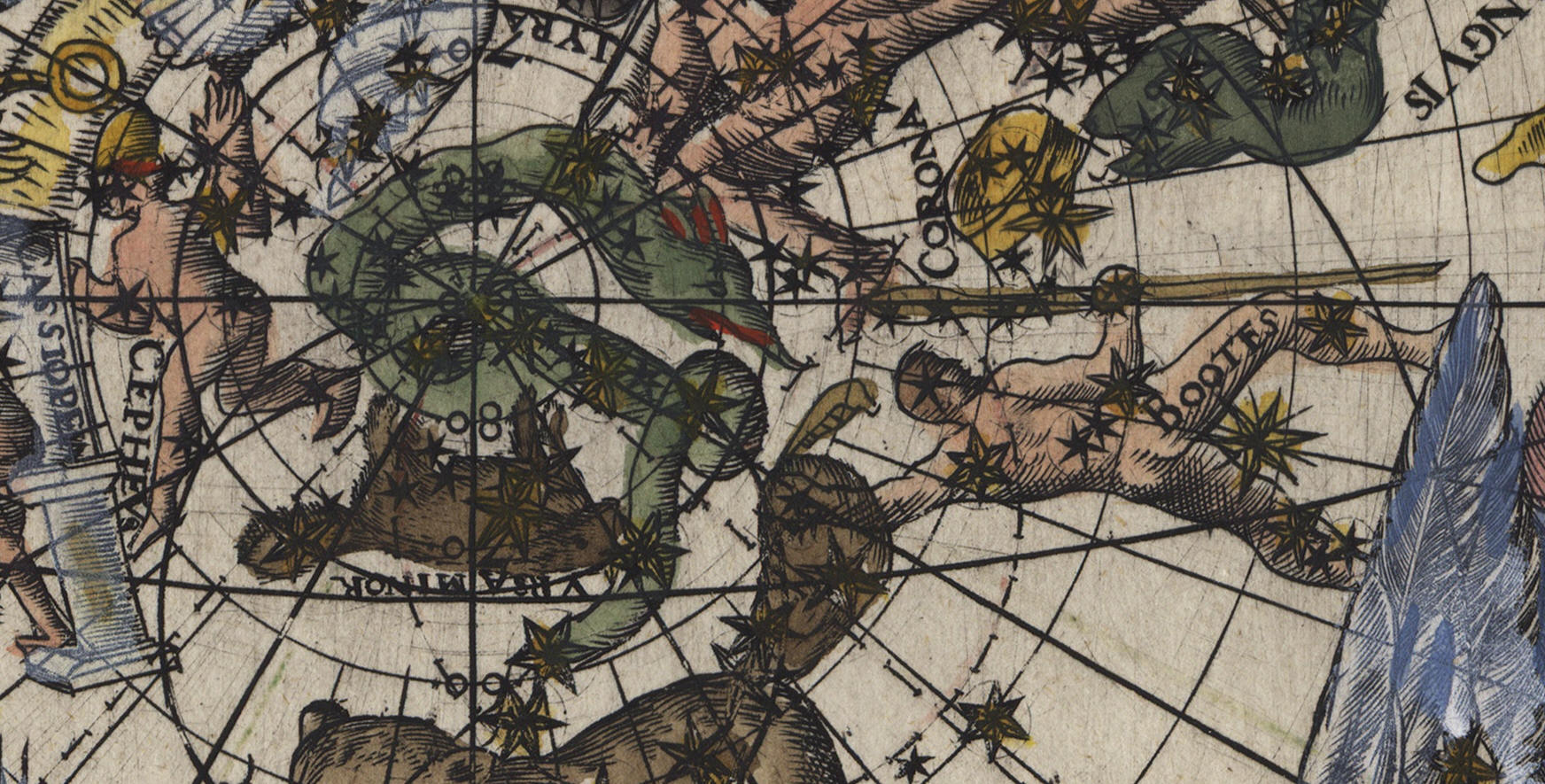
Cepheus, Draco, Ursa Minor, Corona, Bootes
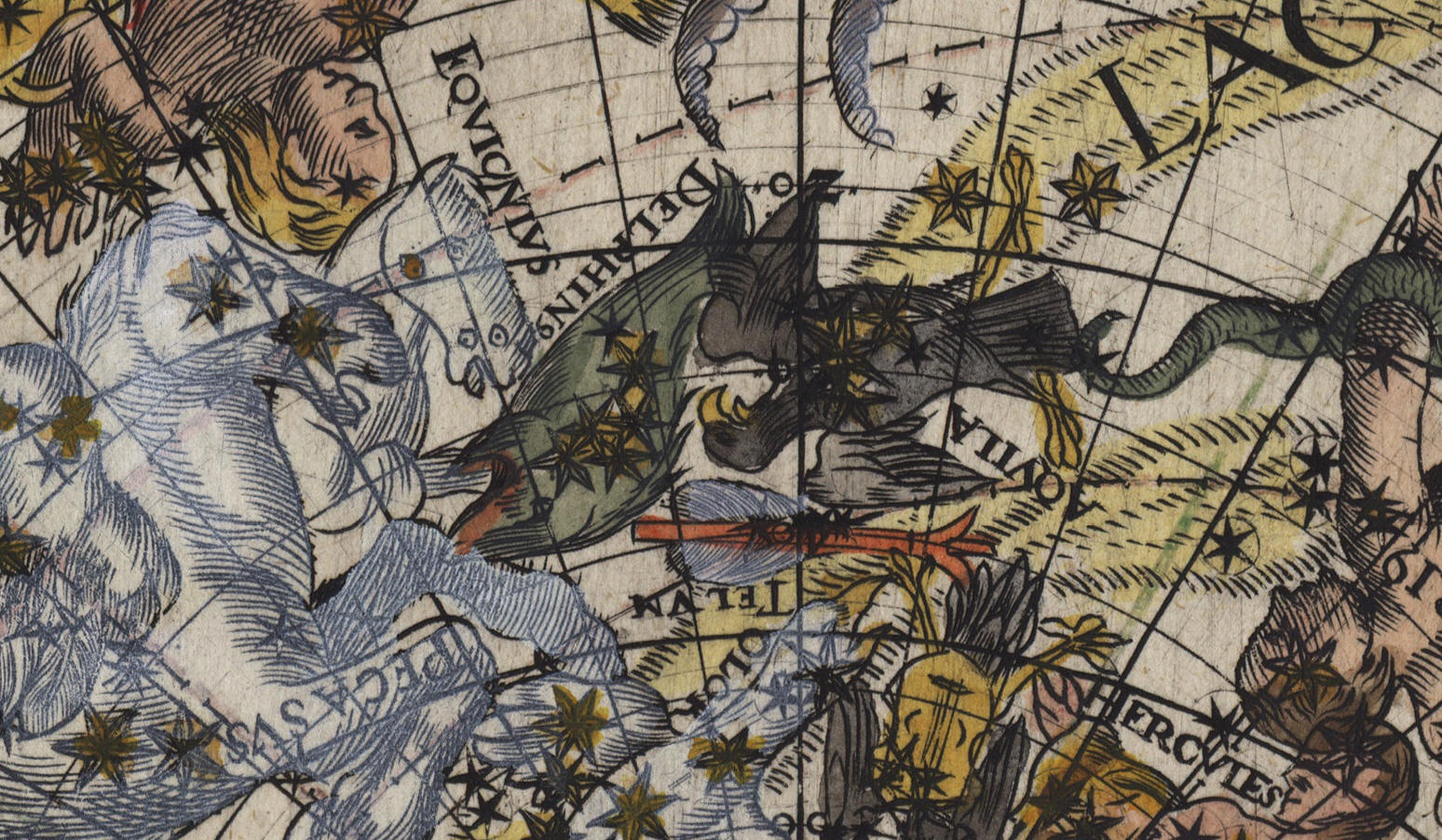
Equiculus, Delphino, Aquila, Telum
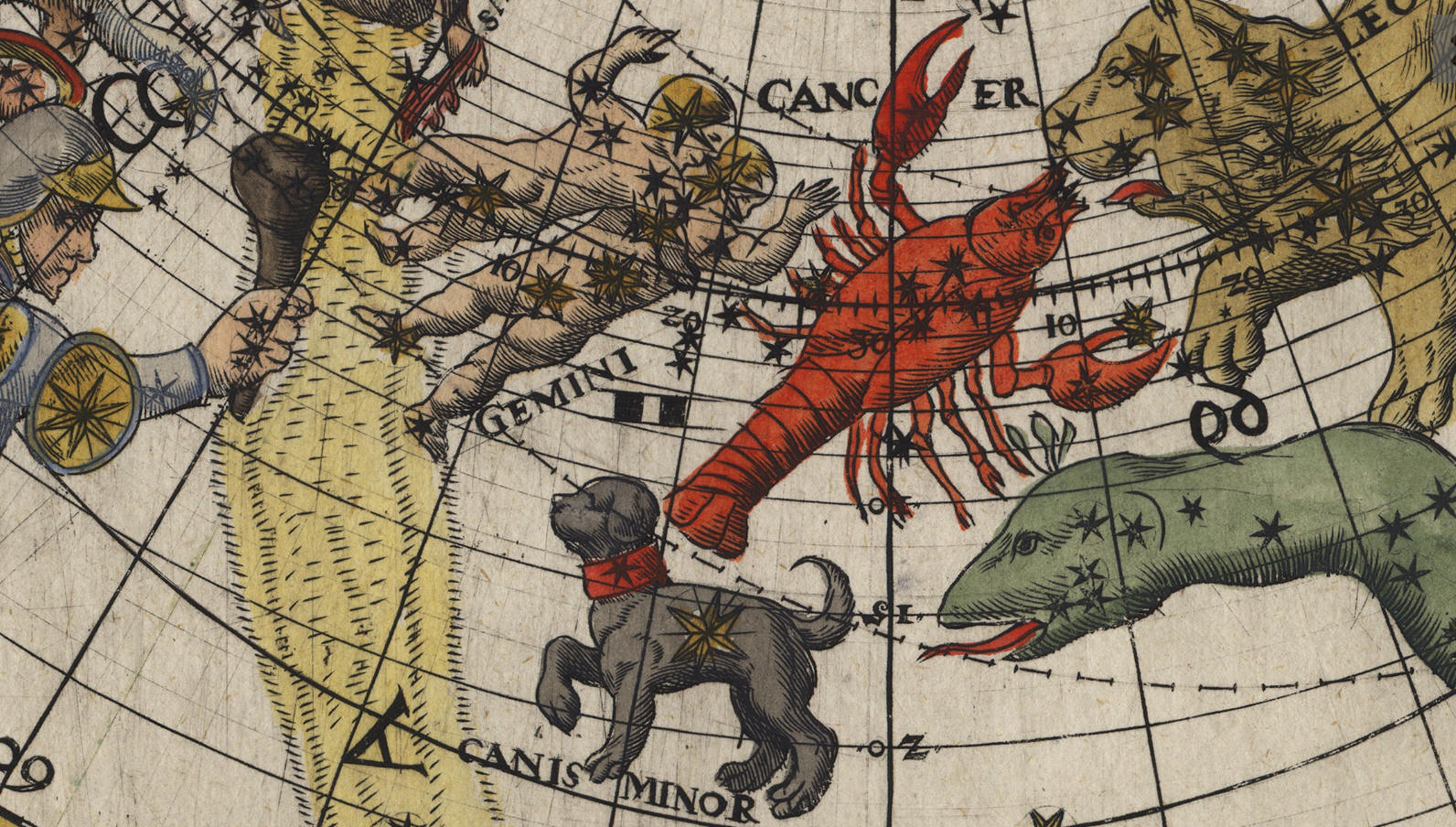
Gemini, Cancer, Canis Minor
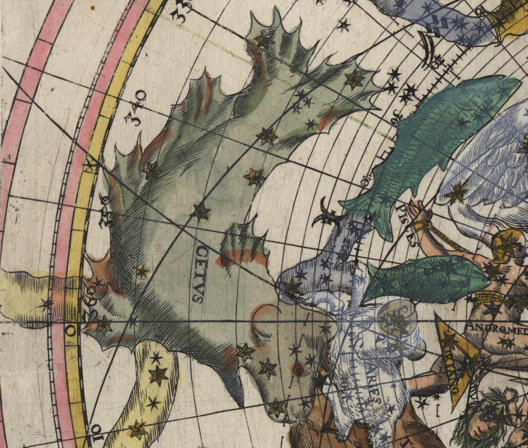
Cetus
La tavola può essere ascritta alla tradizione stilistica di A. Dürer.
Per cortesia di

esamina nella seguenti pagine le influenze delle tavole del Dürer sulla produzione cartografica celeste
Von Dürer beeinflusste Himmelskarten
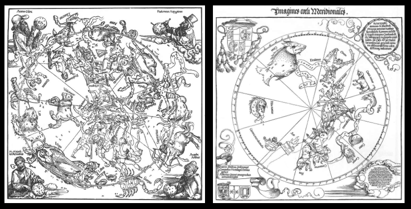
https://www.astronomie-nuernberg.de/index.php?category=duerer&page=sternkarten
https://www.astronomie-nuernberg.de/index.php?category=duerer&page=nachfolger
di FELICE STOPPA
MARZO 2019
